I live 20 minutes from a mountain. Not a big mountain. Not even a respectable mountain by Pacific Northwest standards. But a legit, rocky-summit, peek-a-boo-views-of-Rainier mountain that sits smack in the middle of a suburban neighborhood between Renton and Kent.
And I had no idea it existed until this week.
Echo Mountain tops out at 900 feet. That might be a mountain on the East coast, but it is barely a speed bump compared to what we’ve got in the Cascades. But here’s the thing. You don’t need to drive two hours, fight for parking at a trailhead, or buy yet another parking pass to get there. You park on a residential street, walk into the trees, and ten minutes later you forget you’re surrounded by subdivisions.
That’s a pretty good deal for a Wednesday afternoon.
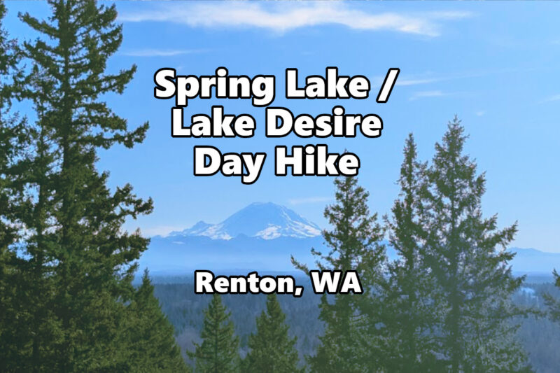
Quick Stats: Echo Mountain at Spring Lake / Lake Desire Park
- Location: Spring Lake / Lake Desire Park, Renton/Fairwood area
- Distance: About 2.5 to 3 miles depending on your route
- Elevation Gain: Roughly 500 feet
- Difficulty: Easy to moderate
- Time: 1 to 1.5 hours
- Parking Pass: None. Free. Zero dollars.
- Dogs: Yes, on leash
- Kid-Friendly: Yes, with one steep section near the summit
- Drive from Auburn: About 20 minutes
- Drive from Seattle: About 30 minutes
- Drive from Renton: About 10 minutes
What You’ll Actually Experience Out There
Let’s talk about the trailhead first, because it’s… different. Unlike most out in the woods trails, you’re driving through a completely normal neighborhood. Houses. Mailboxes. Lady playing ball with her dog in their front yard. Then the road just ends at a small parking area near Spring Lake, and a trail disappears into the trees.
It’s a little surreal. Like finding a wardrobe to Narnia behind someone’s garage.
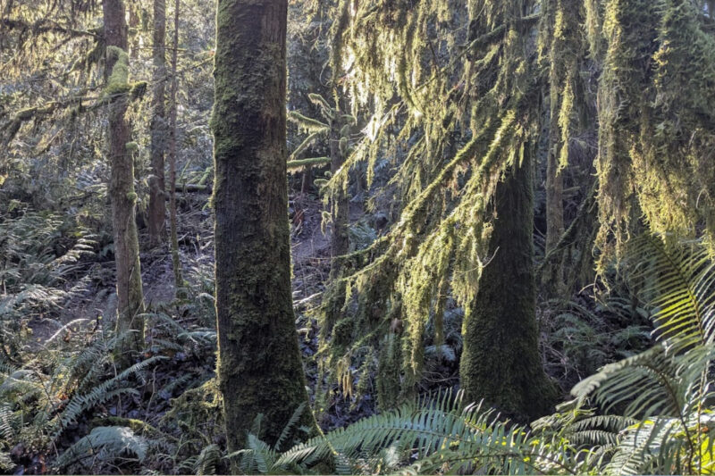
We started out hike by going down the loop to the south. This first section of trail is wide and well-maintained. A crushed gravel path that works through dense second-growth forest along the edge of Spring Lake.
Turning North, you’ll cross a couple of small streams and if you’re paying attention, you might spot the beaver pond off to your left within the first half mile. Look for the dam and the still water. It’s one of those cool little surprises that makes this place feel way more wild than it has any right to.
After the initial flat stretch, you’ll start hitting trail junctions. This is where you need to be able to navigate.
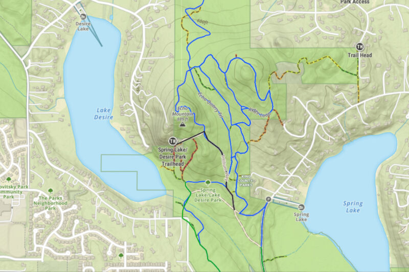
Google maps does not show all the trails in the park. Personally, I am a big fan of OnX. That app typically has all the trails and the website is clutch for mapping out routes and trails.
The trail system here isn’t the worst ever, and there are plenty of signs, but I still missed one turn that came up faster than I expected.
At the top of the Three Lakes Loop South, you will find the turn to go up to the Echo Mountain peak. It isn’t as maintained as the rest of the trails and is the steep part of the hike. The trail up to and down from the peak is the only section I can see anyone really needing trekking poles.
At the top of the trail, you take a side-branch out to a rocky outcropping where you will get the payoff for your ascent.
The Summit: Let’s Talk About Those Views
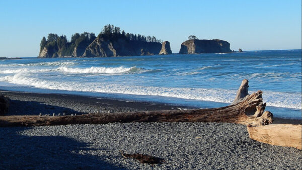
Echo Mountain’s summit is a bald rocky outcrop with some hardy shrubs, and whatever wildflowers decided to show up that season. In the spring, this place reportedly gets covered in chocolate lilies, which is worth timing your visit for if you’re into that sort of thing. A few trees try to block the view, but there is a perfect window for viewing Mount Rainier (if it is out) and the surrounding hills off to the west.
Below you, both Spring Lake and Lake Desire sitting in their little forested bowls. It’s legitimately beautiful. The kind of view that makes you wonder why you’ve been driving to Rattlesnake Ledge with 400 other people when this was right here the whole time.
On a cloudy day? You still get the two lakes and the surrounding forest canopy, which is pretty. But the Rainier views are the headline act here. If you want the full experience, pick a clear day.
We were treated to several groups of Eagles soaring on the midday updrafts, doing slow circles. My suggestion is to bring a chair, your binoculars, and a snack. Stop, relax, and stay a while.
What Actually Surprised Me
A few things caught me off guard in the best way.
The bog. There’s a sphagnum peat bog along the west shore of Spring Lake that feels like it belongs in a nature documentary, not wedged between subdivisions. It’s home to Labrador tea and other unique plants you don’t see on your typical King County trail. There’s a boardwalk section through part of it, though finding it can be an adventure in itself.
The birds. This park is surprisingly alive. Multiple people have reported barred owls here, and they’re apparently pretty vocal. I heard more birdsong on this short hike than I do on some backcountry trips. Woodpeckers, wrens, juncos, and herons down at the lakes. If you’re a birder, bring your binoculars.
The scale of connected green space. Spring Lake/Lake Desire Park is 396 acres on its own, but it connects to McGarvey Park (400 acres), Wetland 14 Natural Area, Petrovitsky Park, Peterson Lake Natural Area, and Lake Youngs Park. That’s over 1,000 acres of contiguous open space with 11 miles of trails. You could spend an entire day exploring and still not see all of it.
The “wait, I’m WHERE?” feeling. Ten minutes in, you genuinely forget you’re in a suburban area. The forest is dense, the creek sounds drown out traffic noise, and the terrain feels like you’re deep in the Issaquah Alps, not a mile from a strip mall.
Real Talk: What Kinda Sucks
You knew this section was coming.
Parking is tiny. The main trailhead parking area fits maybe 8 to 10 cars, and that’s being generous. On a nice weekend morning, you might be parking down the street. Get there early or go on a weekday.
The trail junctions will confuse you. I mentioned the spaghetti trail system, but it bears repeating. There are a LOT of intersections and not all of them are well-marked. Without a map or GPS app, you will take a wrong turn. You won’t get truly lost because you’re never more than a shout from a road, but you might end up doing more miles than you planned. Which honestly isn’t the worst problem to have.
Mud. So much mud. This is the Pacific Northwest and these trails sit in a forested lowland between two lakes and a bog. October through May, expect sections that will absolutely wreck your white trail runners. This has been a pretty dry winter (2025/2026) so when we were there, we encountered only one damp spot in the trail, but I can see it getting muddy under rainy conditions.
Mountain bikers on shared trails. The McGarvey Park section is popular with mountain bikers, which is fine. Just be aware of it if you extend your hike north. The Echo Mountain summit trail itself is hiking only.
Some routes dump you on residential roads. If you take the wrong loop or follow certain AllTrails routes, you’ll end up walking along neighborhood streets to get back to your car. It’s not dangerous or anything, just anticlimactic after being in the forest. Plan your route to stay on trail if that bothers you.
Who This Hike Is Perfect For
Beginners who want something that feels like a real hike without the two-hour drive to the Cascades. You get forest, a summit, views, and interesting terrain without any of the commitment.
Parents with kids who have a moderate amount of energy. The summit scramble is actually fun for kids who like rocks, and the beaver pond and boardwalk sections add some adventure. The total distance is manageable for most school-age kids.
Dog owners looking for a free, leashed-dog-friendly spot with actual terrain variety. No Discover Pass, no Northwest Forest Pass, no nothing. Just show up and walk.
Locals who want a quick after-work escape. If you live in Auburn, Renton, Kent, or the Fairwood area, this is your 20-minutes-from-home forest therapy spot. Get off work, drive over, hike to the summit, be home for dinner.
Anyone who’s sick of fighting for parking at I-90 corridor trailheads. If the idea of driving past bumper-to-bumper traffic at Rattlesnake Ledge or Si makes you want to scream, Echo Mountain is the antidote.
Getting There
From Auburn, head north on SR-167 to I-405 North. Take the SR-169 exit toward Renton/Maple Valley. From SR-169, take 196th Avenue SE, then SE 183rd Street to East Spring Lake Drive. Follow the road around the lake to the trailhead at the end of West Spring Lake Drive SE.
From Seattle, take I-405 South to the same SR-169 exit.
From Renton, you’re practically there already. Head east toward Fairwood and follow SE Petrovitsky Road to 196th Avenue SE.
There’s a boat launch near the trailhead on Spring Lake if you want to add some water time to your trip. Restrooms are available at nearby Petrovitsky Park, not at the trailhead itself.
The park is also accessible via Metro bus route 148 to Fairwood if you’re trying to keep it car-free.
Best time to visit: Weekday afternoons are practically empty. Weekend mornings fill up the small parking area quickly. Spring is prime time for wildflowers on the summit. Summer gives you the best shot at Rainier views. Fall colors are solid. Winter is fine but muddy. Year-round access, no seasonal closures.
Want More Miles? Extend Your Adventure
If the Echo Mountain loop feels too short, you’ve got options.
Head north from the park into McGarvey Park Open Space for additional trails. The mountain biking trails there add variety if you don’t mind sharing the path, and the Powerline Trail gives you views of the Olympic Mountains on a clear day.
Petrovitsky Park sits adjacent to McGarvey and has a playground, sports fields, and picnic areas. It’s a solid post-hike hangout spot if you’ve got kids who still have energy to burn.
For a longer day, the Lake Youngs Trail connects to this network and adds a completely different vibe. It’s a flat, paved loop around the lake, which is a nice contrast to the forest trails.
If you’re heading north after your hike, Renton has solid food options. The taco trucks along Rainier Avenue are worth a stop.
Worth It Factor
Let me be straight with you. Echo Mountain is not replacing a trip to the Enchantments. It’s not going to be the highlight of your Pacific Northwest hiking career. Nobody’s going to be jealous when you post about it.
But that’s kind of the point.
This is the hike you do on a random Wednesday when you’ve got 90 minutes and need to get into some trees. It’s the one you take a friend to when they say they want to start hiking but aren’t sure they’re ready for “a real one.” It’s the neighborhood secret that locals love precisely because it stays under the radar.
900 feet of elevation, two lakes, a bog full of rare plants, a bald summit with Cascade views, and zero parking fees. Twenty minutes from my front door.
Yeah. I’ll be going back.
Have you hiked Echo Mountain or explored the Spring Lake / Lake Desire trail system? Got tips or stories I missed? Drop them in the comments below or shoot me an email at cliff@10toestravel.com. I’m always looking for more of these hidden local gems, so if you know of one, I want to hear about it.